The United Kingdom is a hiker’s paradise, boasting some of the most diverse and stunning landscapes in Europe. From the rugged beauty of the Scottish Highlands to the rolling hills of the English countryside, there is a hiking trail for every type of adventurer. In this comprehensive guide, we will explore the top 10 most popular hikes in the UK, offering detailed information about each trail, including route details, what you can see, accessibility, length, and duration. So, lace up your hiking boots, grab your backpack, and let’s embark on an epic journey through the United Kingdom’s finest hiking trails.
1. Hadrian’s Wall Path
Route Details
Location: Northern England
Distance: 84 miles (135 km)
Duration: 6-7 days
Difficulty: Moderate
Access: Best accessed from Newcastle or Carlisle
Hadrian’s Wall Path is a historic trail that follows the footsteps of Roman soldiers. This UNESCO World Heritage Site takes you along the ancient Hadrian’s Wall, which once marked the northern frontier of the Roman Empire. The path offers breathtaking views of the Northumberland countryside and is dotted with well-preserved forts and ruins.
What You Can See
- Roman forts and settlements
- Scenic views of Northumberland National Park
- Sycamore Gap, famously featured in the movie “Robin Hood: Prince of Thieves”
- Birdwatching opportunities in the nearby Haltwhistle Burn
How to Get There
The trail can be accessed from the cities of Newcastle and Carlisle, both well-connected by train and road. It’s advisable to plan your hike starting from one of these points.
Is It Easy or Hard?
The Hadrian’s Wall Path is considered moderately challenging due to its length, but it is suitable for hikers with some experience. The terrain is varied, including sections of gravel, grass, and uneven paths.
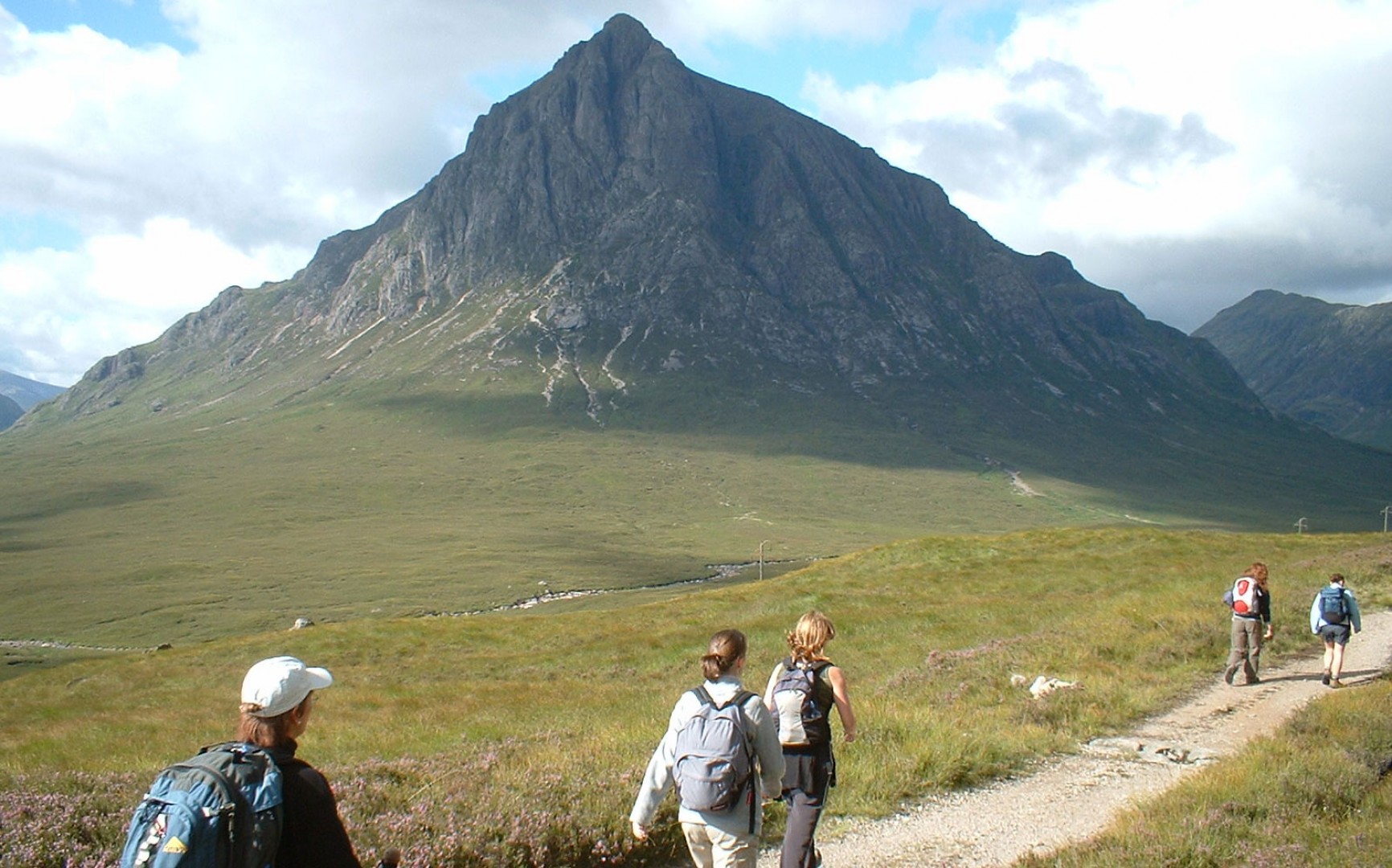
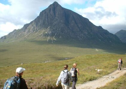
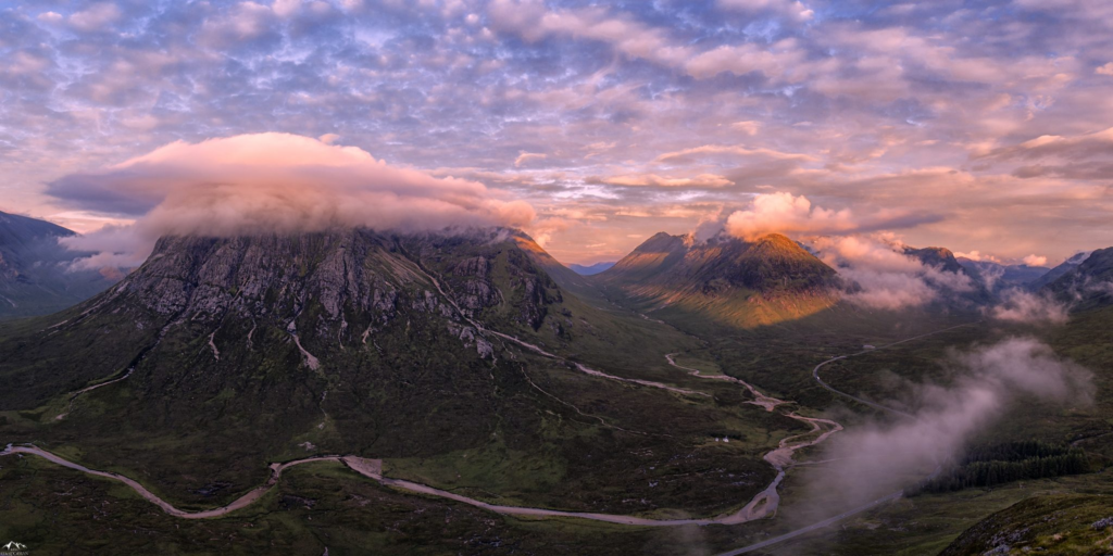
2. West Highland Way
Route Details
Location: Scotland
Distance: 96 miles (154 km)
Duration: 7-8 days
Difficulty: Moderate to challenging
Access: Start from Glasgow or Milngavie
The West Highland Way is Scotland’s most famous long-distance trail, taking you through some of the country’s most awe-inspiring landscapes. This hike is a true adventure that leads you from the outskirts of Glasgow into the heart of the Scottish Highlands.
What You Can See
- Loch Lomond, the largest freshwater lake in Scotland
- Rannoch Moor, a vast wilderness area
- The Devil’s Staircase, a challenging ascent with stunning views
- Glencoe, a picturesque and historically significant valley
How to Get There
You can start your journey from Glasgow, easily accessible by train or plane. Milngavie, a suburb of Glasgow, is the traditional starting point for the West Highland Way.
Is It Easy or Hard?
The West Highland Way offers a mix of terrain, from well-maintained paths to rugged mountain trails. Some sections are challenging, making it suitable for experienced hikers.
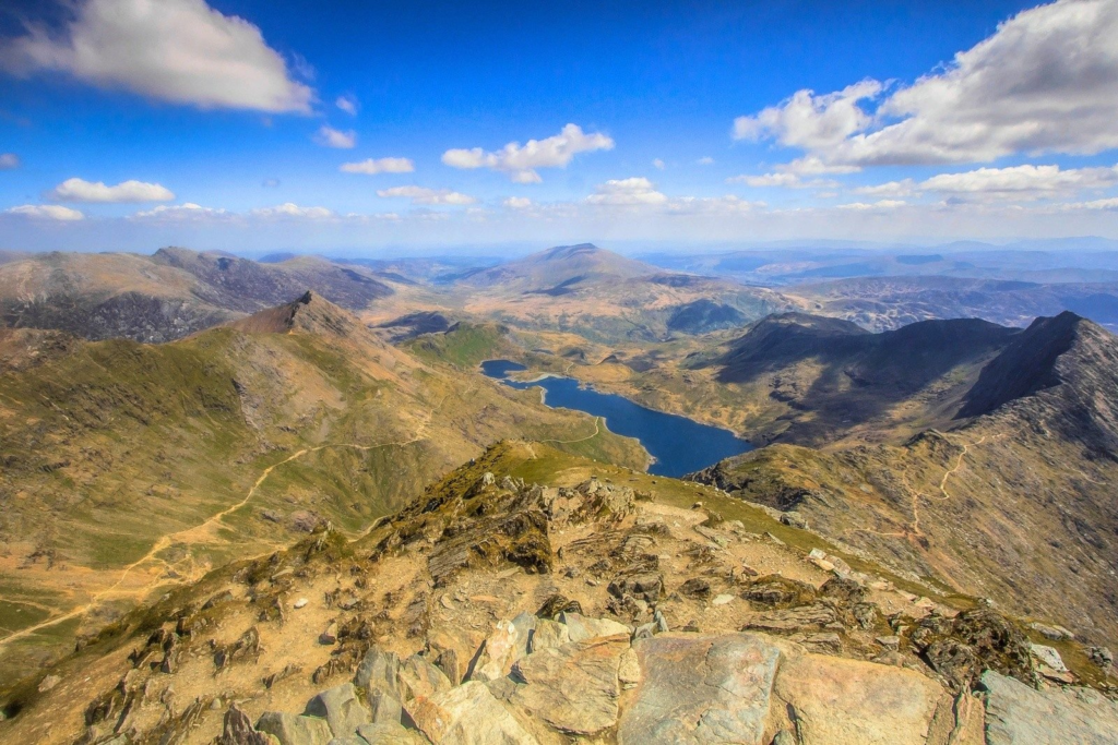
3. Snowdonia – Mount Snowdon
Route Details
Location: Wales
Distance: Varies by route (average 7-9 miles)
Duration: 4-6 hours (up and down)
Difficulty: Moderate to challenging
Access: Llanberis or Pen-y-Pass
Mount Snowdon, the highest peak in Wales and England, offers breathtaking panoramic views and a range of hiking routes suitable for various skill levels. Whether you’re a seasoned mountaineer or a beginner, there’s a trail for you on Snowdon.
What You Can See
- Stunning vistas of Snowdonia National Park
- Llyn Tegid (Bala Lake) in the distance
- Diverse flora and fauna
- An opportunity to conquer Wales’ highest peak
How to Get There
The most popular starting points are Llanberis and Pen-y-Pass. Llanberis is accessible by train and car, while Pen-y-Pass can be reached by car.
Is It Easy or Hard?
The difficulty of hiking Mount Snowdon varies depending on the route chosen. The Llanberis Path is considered the easiest, while routes like the Crib Goch Ridge are extremely challenging and should only be attempted by experienced climbers.
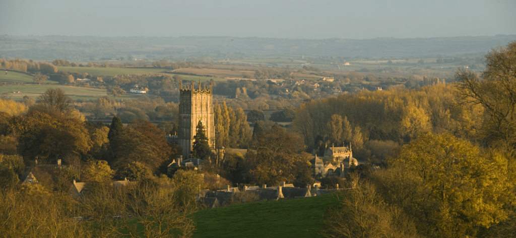
4. The Cotswold Way
Route Details
Location: England (Southwest)
Distance: 102 miles (164 km)
Duration: 7-10 days
Difficulty: Moderate
Access: Start from Chipping Campden or Bath
The Cotswold Way is a quintessentially English hiking trail that meanders through the Cotswolds Area of Outstanding Natural Beauty. This route combines charming villages, rolling hills, and historic sites for a delightful walking experience.
What You Can See
- Idyllic Cotswold villages with honey-colored stone houses
- Broadway Tower, an iconic folly with panoramic views
- Bath’s Roman Baths and Georgian architecture
- Picturesque countryside landscapes
How to Get There
Begin your journey from either Chipping Campden or Bath, both accessible by train and road.
Is It Easy or Hard?
The Cotswold Way is considered a moderately easy trail, suitable for hikers of various experience levels. It primarily consists of well-marked paths and gentle ascents.
5. The South Downs Way
Route Details
Location: England (South)
Distance: 100 miles (160 km)
Duration: 7-9 days
Difficulty: Moderate
Access: Start from Eastbourne or Winchester
The South Downs Way takes you on a journey through the picturesque South Downs National Park in southern England. With its rolling hills, chalk cliffs, and panoramic views of the English Channel, this trail offers a taste of rural England at its finest.
What You Can See
- The Seven Sisters, a series of iconic chalk cliffs
- Winchester, an ancient cathedral city
- Rolling countryside with charming villages
- Diverse flora and fauna in the national park
How to Get There
Begin your hike from either Eastbourne or Winchester, both reachable by train and car.
Is It Easy or Hard?
The South Downs Way is a moderately challenging trail due to its length, but it is well-maintained and suitable for hikers with varying levels of experience.
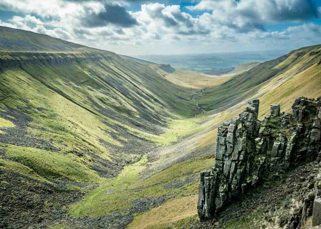
6. The Pennine Way
Route Details
Location: England and Scotland (North)
Distance: 268 miles (431 km)
Duration: 16-20 days
Difficulty: Challenging
Access: Start from Edale or Kirk Yetholm
The Pennine Way is one of the UK’s most challenging long-distance hikes, traversing the rugged landscapes of northern England and the Scottish Borders. This trail offers a true wilderness experience and is not for the faint of heart.
What You Can See
- The Peak District, Britain’s first national park
- Cross Fell, the highest point in the Pennines
- The stunning Yorkshire Dales
- The Cheviot Hills in the Scottish Borders
How to Get There
Begin your epic journey from either Edale in England’s Peak District or Kirk Yetholm in Scotland, both reachable by train and car.
Is It Easy or Hard?
The Pennine Way is a demanding trail, primarily due to its length and challenging terrain. It is recommended for experienced hikers who are well-prepared for unpredictable weather conditions.
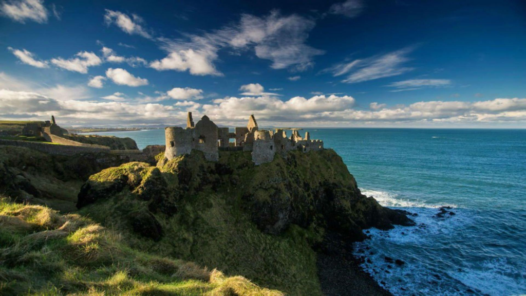
7. The Causeway Coast Way
Route Details
Location: Northern Ireland
Distance: 33 miles (53 km)
Duration: 2-3 days
Difficulty: Moderate
Access: Start from Portstewart or Ballycastle
The Causeway Coast Way in Northern Ireland offers a stunning coastal hike along the rugged and dramatic shoreline of the North Atlantic. This trail is famous for its unique geological formations and picturesque coastal villages.
What You Can See
- Giant’s Causeway, a UNESCO World Heritage Site
- Carrick-a-Rede Rope Bridge
- Dunluce Castle, perched on a cliff
- Breathtaking views of the North Antrim Coast
How to Get There
You can start your hike from either Portstewart or Ballycastle, both accessible by car and public transport.
Is It Easy or Hard?
The Causeway Coast Way is a moderately challenging trail with some steep sections, but it is suitable for hikers with moderate experience.
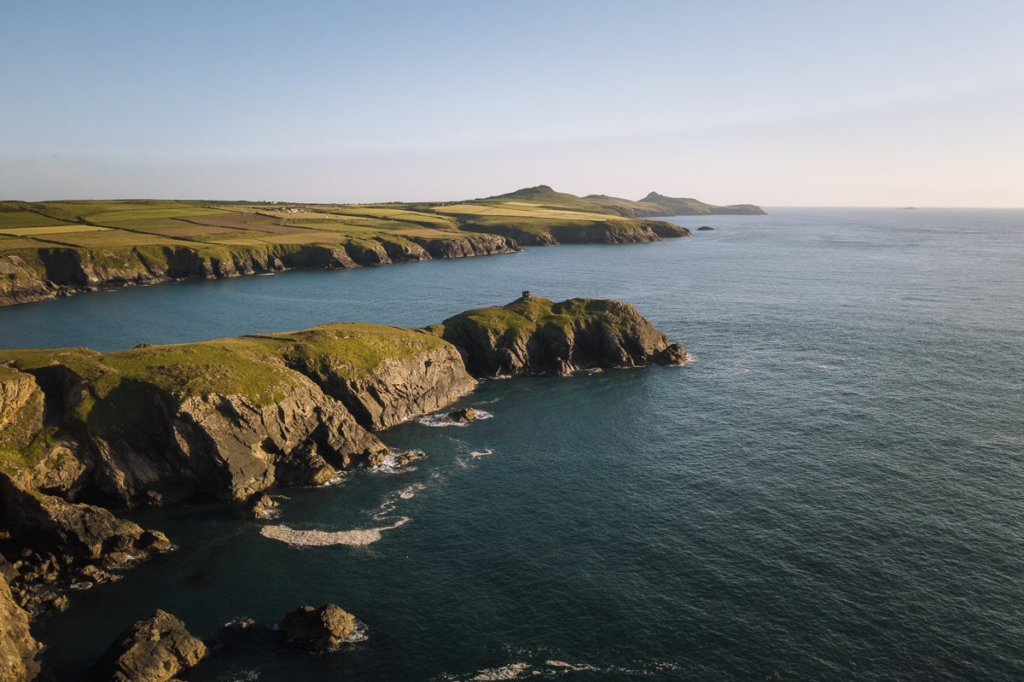
8. The Pembrokeshire Coast Path
Route Details
Location: Wales (West)
Distance: 186 miles (299 km)
Duration: 10-15 days
Difficulty: Moderate to challenging
Access: Start from St. Dogmaels or Amroth
The Pembrokeshire Coast Path offers a stunning journey along the rugged and wild coastline of southwest Wales. This trail is a paradise for nature lovers, with diverse wildlife and breathtaking seascapes.
What You Can See
- Unique rock formations like the Green Bridge of Wales
- Secluded sandy beaches and hidden coves
- Puffin and seal colonies on Skomer Island
- Coastal villages with charming pubs and seafood restaurants
How to Get There
Begin your adventure from either St. Dogmaels or Amroth, both accessible by car and public transport.
Is It Easy or Hard?
The Pembrokeshire Coast Path can be challenging due to its length and undulating terrain, but it is suitable for hikers with some experience. It’s important to be prepared for changing weather conditions, as the path is exposed to the sea.
9. The Mourne Mountains
Route Details
Location: Northern Ireland
Distance: Varies by route (average 5-8 miles)
Duration: 4-6 hours (up and down)
Difficulty: Moderate to challenging
Access: Start from Newcastle or Hilltown
The Mourne Mountains in Northern Ireland offer a compact but challenging hiking experience. These granite peaks rise dramatically from the Irish Sea, providing stunning vistas and a rewarding challenge for hikers.
What You Can See
- Slieve Donard, the highest peak in Northern Ireland
- Silent Valley Reservoir
- Ben Crom Reservoir
- Granite tors and rocky terrain
How to Get There
You can start your hike from either Newcastle or Hilltown, both accessible by car and public transport.
Is It Easy or Hard?
The difficulty of hiking in the Mourne Mountains varies depending on the route chosen. Some routes are moderately challenging, while others, especially those leading to the summits, can be quite demanding.
10. The Isle of Skye – The Fairy Pools
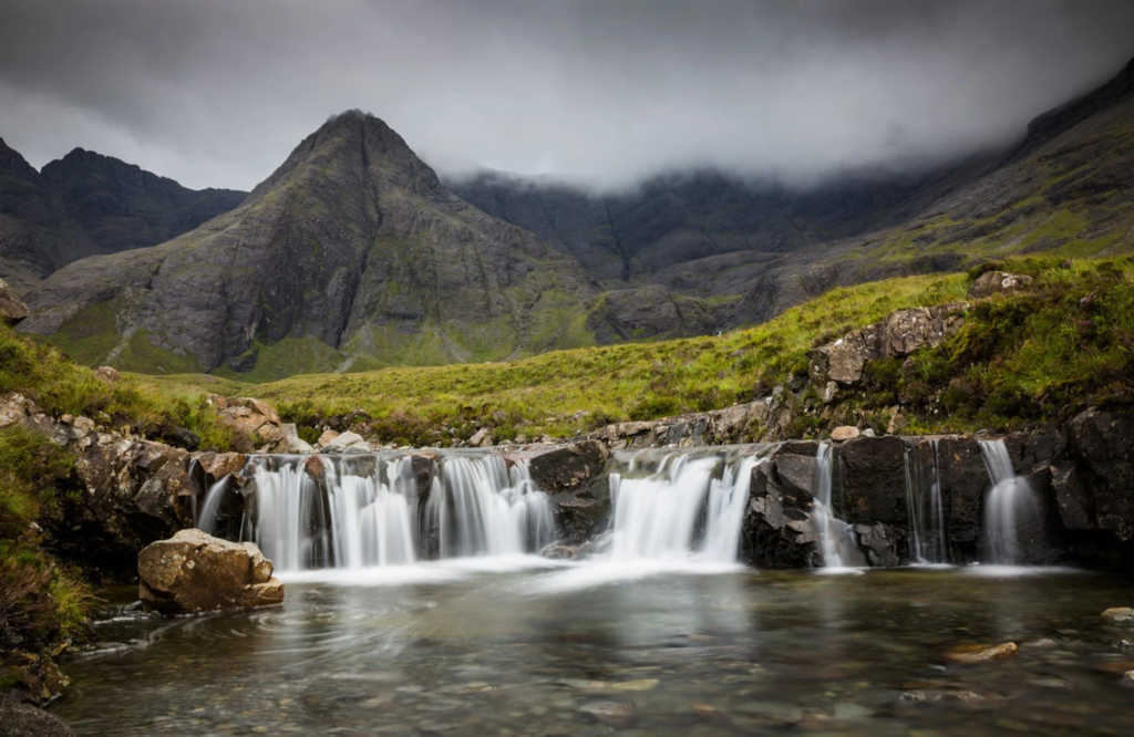
Route Details
Location: Scotland (Isle of Skye)
Distance: 2.4 miles (3.8 km)
Duration: 2-3 hours
Difficulty: Easy to moderate
Access: Start from Glen Brittle
The Isle of Skye in Scotland is renowned for its mystical and otherworldly landscapes, and the Fairy Pools trail is a prime example. This relatively short hike takes you to a series of crystal-clear, aquamarine pools beneath the Black Cuillin Mountains.
What You Can See
- The enchanting Fairy Pools, perfect for a refreshing swim
- Views of the Black Cuillin Mountains
- Waterfalls and cascades in a magical setting
- Unique geological formations
How to Get There
Begin your hike from Glen Brittle on the Isle of Skye, accessible by car or public transport.
Is It Easy or Hard?
The Fairy Pools trail is relatively easy, with a well-defined path. However, it can become slippery in wet conditions, so appropriate footwear is recommended.
Top 10 Hiking Trails in the United Kingdom
The United Kingdom offers an incredible variety of hiking trails, from challenging long-distance routes to shorter, more accessible paths. Whether you’re seeking dramatic coastal vistas, historic landmarks, or serene countryside landscapes, there’s a hike in the UK to suit every taste and skill level. So, pick your trail, pack your gear, and get ready to explore the natural beauty of this diverse and stunning country. Happy hiking!