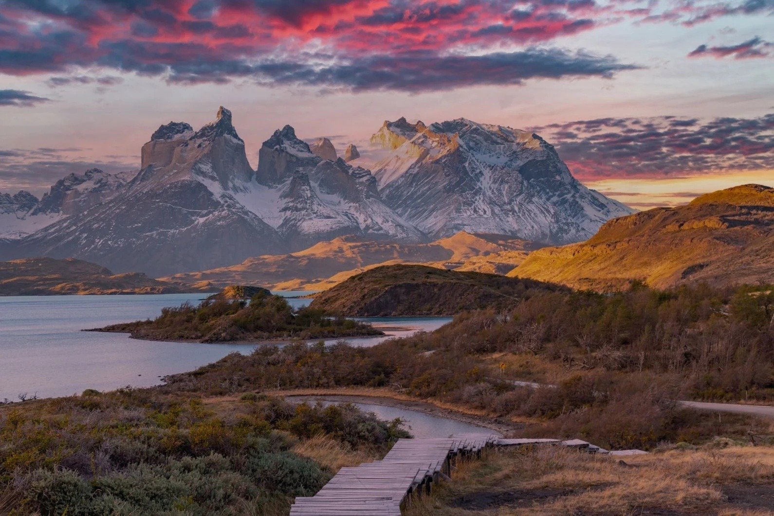
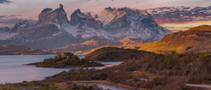
Patagonia, a rugged, awe-inspiring region split between Argentina and Chile, beckons adventurers from around the globe with its untamed wilderness, towering mountains, and breathtaking glaciers. Known for its vast expanses of untouched nature, Patagonia offers some of the world’s most spectacular hiking trails, attracting both novice trekkers and seasoned mountaineers alike. In this extensive guide, we’ll unveil the top 10 hiking trails in Patagonia, each offering a unique journey through landscapes so stunning they seem otherworldly. From the iconic Torres del Paine Circuit to the secluded paths of the Sierra Baguales Fossil Fields, prepare to embark on adventures that will etch themselves into your memory forever.
The Enchantment of Patagonia
Why Choose Patagonia for Hiking?
Patagonia‘s allure lies not only in its dramatic landscapes but also in its diverse ecosystems, ranging from arid steppes to dense forests, and ice fields to pristine lakes. This region is a mosaic of natural wonders, providing a backdrop for some of the most unforgettable hiking experiences on the planet.
Hikers in Patagonia are treated to a visual feast: towering granite peaks, turquoise waters of glacial lakes, and glaciers that glisten under the southern sun. The diverse terrain caters to a wide array of interests and skill levels, making it a premier destination for everyone from casual day hikers to those seeking challenging multi-day treks.
The area’s rich biodiversity adds another layer of intrigue to its trails. Trekking in Patagonia, adventurers might encounter a range of wildlife, including Andean condors soaring above, guanacos grazing in the fields, and the elusive puma watching from a distance. Moreover, the region’s flora varies dramatically with elevation and latitude, offering hikers a chance to traverse through distinct ecological zones within a single journey.
Now, let’s explore the top 10 hiking trails that showcase the very best of Patagonia’s enchanting landscapes.
Top 10 Hiking Trails in Patagonia
Torres del Paine Circuit
Overview
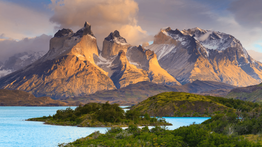
The Torres del Paine Circuit, also known as the “O” circuit, is an epic journey that encircles the Paine Massif in Chile’s Torres del Paine National Park. This trail is a mecca for trekkers worldwide, offering unparalleled views of glaciers, lakes, and the park’s famous granite towers.
Trail Details
- Length: Approximately 130 kilometers (80 miles)
- Duration: 7-10 days
- Difficulty: Moderate to challenging
Highlights
Hikers on the Torres del Paine Circuit will witness the majestic Towers of Paine, the expansive Grey Glacier, and the striking Valle Francés. The diversity of landscapes, from vast pampas to rugged mountain terrains, makes every day on the trail a new discovery.
Getting There
The nearest major town is Puerto Natales, accessible by plane or bus from Santiago, Chile. From Puerto Natales, buses run to Torres del Paine National Park, where trekkers can start their adventure.
Essential Tips
- Best visited during the Southern Hemisphere’s spring or summer (October to April).
- Booking campsites in advance is mandatory.
- Prepare for rapidly changing weather conditions.
More about the Torres del Paine Circuit
Fitz Roy Trek
Overview
The Fitz Roy Trek, located in Argentina’s Los Glaciares National Park, offers some of the most iconic views of the Patagonian landscape, including the majestic Mount Fitz Roy. This trek can be done as a series of day hikes from the town of El Chaltén or as a more extended multi-day backpacking trip.
Trail Details
- Length: Various options, from 10 to 36 kilometers (6 to 22 miles)
- Duration: 1 to 4 days
- Difficulty: Easy to moderate
Highlights
The trek features stunning views of the Fitz Roy massif, cerulean blue lakes, and dramatic ice fields. Highlights include Laguna de los Tres, with its close-up views of Mount Fitz Roy, and Laguna Torre, overlooked by the imposing Cerro Torre.

Getting There
El Chaltén serves as the base for exploring Fitz Roy and is accessible by bus from El Calafate, which has an airport with flights from Buenos Aires.
Essential Tips
- The best time to visit is from November to April.
- Weather in Patagonia can be unpredictable, so be prepared with layered clothing.
- No permits are required for day hikes, making spontaneous adventures possible.
Learn more about the Fitz Roy Trek
Perito Moreno Glacier Trek
Overview
The Perito Moreno Glacier, a highlight of Argentina’s Los Glaciares National Park, offers a unique opportunity to hike on one of the world’s few advancing glaciers. This trek provides a rare chance to explore the glacier’s surface, with its deep crevasses, seracs, and stunning ice formations.
Trail Details
- Length: Various, but the mini-trekking option is about 1.5 hours on the ice.
- Duration: Half-day to full-day tours.
- Difficulty: Moderate.
Highlights
The trek on Perito Moreno is more than just a hike; it’s an exploration of an active glacier. Participants can witness the glacier’s dynamic nature, listen to the ice creaking and groaning, and watch as massive chunks of ice calve off into Lake Argentino.
Getting There
The glacier is accessible from the town of El Calafate, where visitors can join guided tours that include boat rides across Lake Argentino to the glacier’s edge.
Essential Tips
- Tours operate from September to April.
- Advance booking is essential, especially during peak season.
- Wear warm, waterproof clothing and sunglasses.
Discover the Perito Moreno Glacier Trek
The Huemul Circuit
Overview
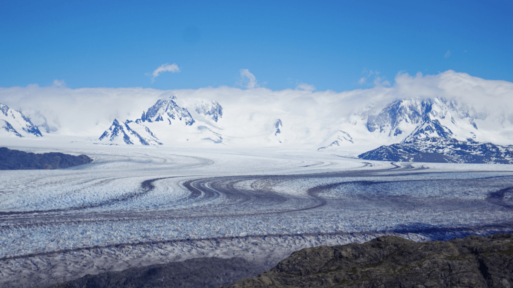
The Huemul Circuit is a challenging trek around the Huemul Massif, offering some of the most remote and spectacular scenery in Argentine Patagonia. This four-day hike is known for its physical demands and the rewards of seeing untouched wilderness areas.
Trail Details
- Length: Approximately 60 kilometers (37 miles).
- Duration: 4 days.
- Difficulty: Challenging.
Highlights
This circuit features breathtaking views of the Southern Patagonian Ice Field, massive glaciers, and pristine mountain lakes. A key highlight is crossing the Viedma Glacier and navigating the Tyrolean traverse over rivers.
Getting There
The trek starts and ends in El Chaltén, which is accessible by bus from El Calafate.
Essential Tips
- Due to its difficulty, this trek is recommended for experienced hikers.
- Special equipment for glacier crossing and river fording is required.
- Permits and a mandatory orientation session are required to tackle the Huemul Circuit.
Cerro Castillo Trek
Overview
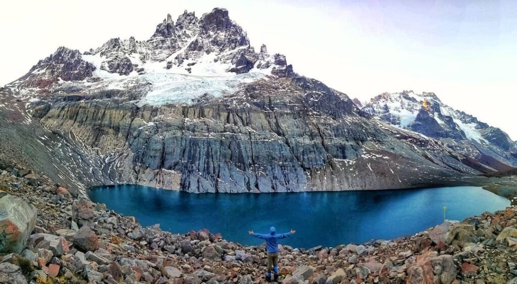
The Cerro Castillo Trek is a less-traveled path that takes adventurers through the heart of Chilean Patagonia, offering stunning views of Cerro Castillo, a mountain famous for its castle-like spires. This trek is an excellent alternative for those looking to escape the more crowded routes in Patagonia.
Trail Details
- Length: Approximately 52 kilometers (32 miles).
- Duration: 4 to 5 days.
- Difficulty: Moderate to challenging.
Highlights
Hikers will encounter dramatic mountain landscapes, pristine glacial lakes, and dense forests. The trek culminates with a breathtaking view of the Cerro Castillo itself. Along the way, trekkers may spot wildlife such as condors, foxes, and possibly even huemuls, the endangered Andean deer.
Getting There
The trek begins near the village of Villa Cerro Castillo, accessible by bus from Coyhaique, the largest city in the Aysén Region of Chile.
Essential Tips
- The best time to hike is from November to March.
- Be prepared for variable weather conditions, including strong winds and sudden temperature changes.
- Camping sites are available along the route, but hikers should be self-sufficient.
More about the Cerro Castillo Trek
Los Dientes de Navarino
Overview
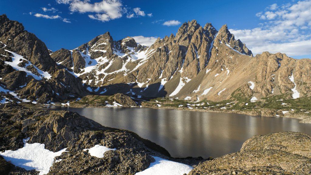
Los Dientes de Navarino is the southernmost trek in the world, located on Navarino Island near the town of Puerto Williams, Chile. This remote circuit takes hikers through a landscape unlike any other, marked by jagged peaks, alpine lakes, and the rugged wilderness of the far south.
Trail Details
- Length: Approximately 53 kilometers (33 miles).
- Duration: 5 to 6 days.
- Difficulty: Challenging.
Highlights
The circuit offers unparalleled solitude and the chance to explore untouched landscapes. The trail provides stunning views of the Beagle Channel and the jagged teeth-like peaks that give the trek its name. This is a unique opportunity to hike at the edge of the world.
Getting There
Puerto Williams can be reached by flight from Punta Arenas or by ferry from Ushuaia, Argentina. The trek starts just outside of Puerto Williams.
Essential Tips
- Ideal for experienced hikers looking for an off-the-beaten-path adventure.
- The trekking season runs from December to March.
- Weather can be unpredictable, and preparation for cold, wind, and rain is essential.
French Valley Trek
Overview
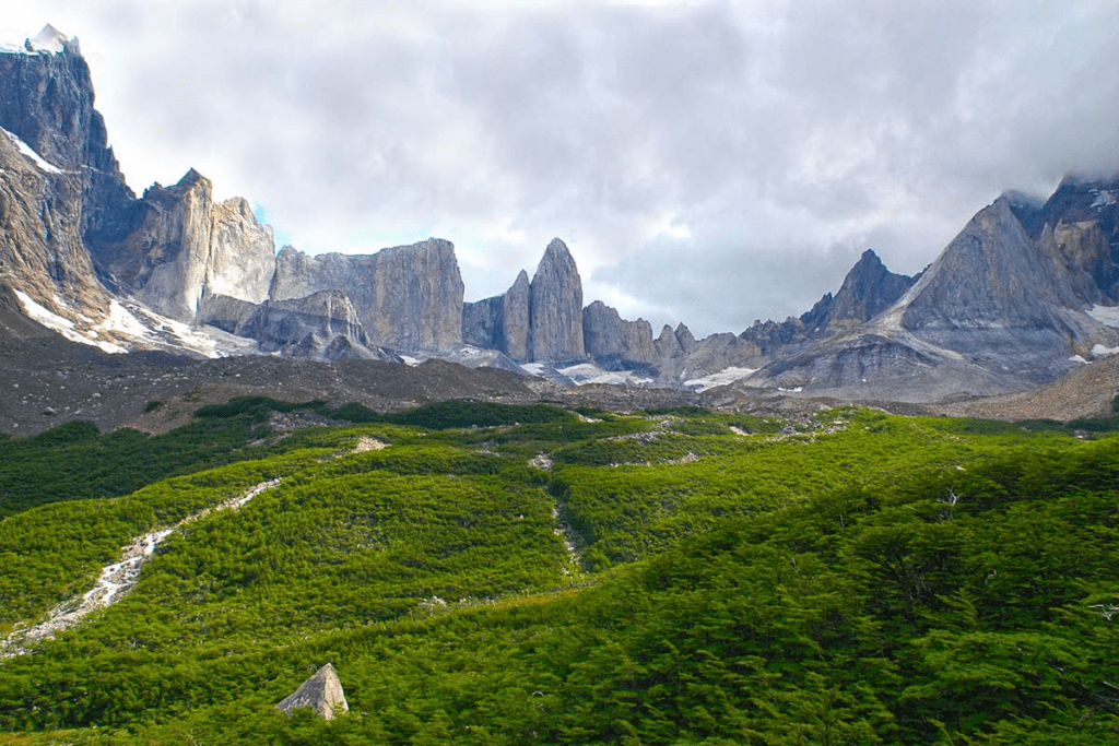
Part of the famous W Trek in Torres del Paine National Park, the French Valley Trek is a stunning day hike that leads adventurers into the heart of the Paine Massif. This trek is known for its panoramic views of granite peaks, hanging glaciers, and vibrant, lush valleys.
Trail Details
- Length: Approximately 24 kilometers (15 miles) round trip from Paine Grande Lodge.
- Duration: 8 to 10 hours.
- Difficulty: Moderate.
Highlights
The trek takes hikers up the French Valley, offering close-up views of the Paine Grande and Los Cuernos peaks, as well as the French Glacier. The auditory experience of the glacier calving and the sight of ice avalanches make this trek unforgettable.
Getting There
The starting point is the Paine Grande Lodge, accessible by boat from Pudeto (reached by bus from Puerto Natales). This trek is usually part of a larger itinerary within the W or O circuits in Torres del Paine.
Essential Tips
- Best time to hike is during the Southern Hemisphere’s summer (November to March).
- Weather can change rapidly; be prepared for sun, rain, and wind.
- While part of the W Trek, the French Valley can be a standalone day hike for those short on time.
Explore the French Valley Trek
Laguna de los Tres
Overview
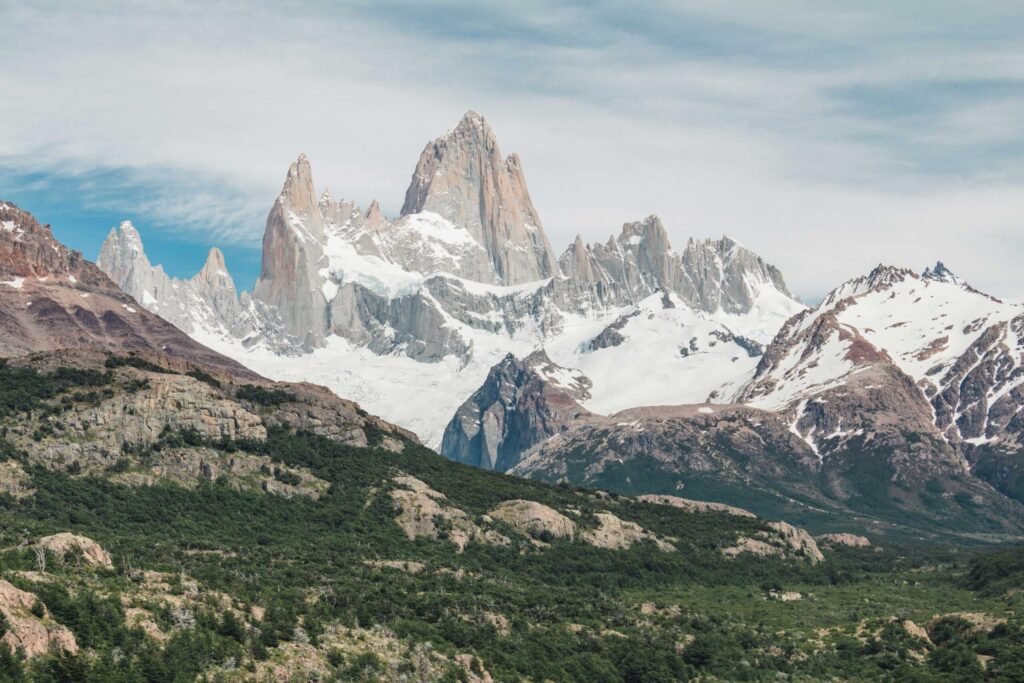
Laguna de los Tres is arguably the most famous trek in the Argentine side of Patagonia, renowned for its stunning views of Mount Fitz Roy. This challenging day hike culminates at a beautiful glacial lake, offering one of the best viewpoints of the iconic mountain.
Trail Details
- Length: Approximately 26 kilometers (16 miles) round trip.
- Duration: 8 to 10 hours.
- Difficulty: Moderate to challenging.
Highlights
The climax of this hike is the breathtaking view of Mount Fitz Roy and its surrounding peaks, reflected in the turquoise waters of Laguna de los Tres. The path also passes by Laguna Capri, another scenic spot with magnificent views of the Fitz Roy massif.
Getting There
The trailhead starts near the town of El Chaltén, Argentina’s trekking capital. El Chaltén is accessible by bus from El Calafate, where the nearest airport is located.
Essential Tips
- The best months for this trek are October through April.
- Start early to maximize daylight and improve chances of clear views.
- The final ascent is steep and can be challenging, but the view is well worth the effort.
Loma del Pliegue Tumbado
Overview
Loma del Pliegue Tumbado offers a less frequented route with panoramic views encompassing the entire region around El Chaltén, including the iconic peaks of Fitz Roy and Cerro Torre, as well as the vast Patagonian steppe. This trek provides a unique perspective on the landscape, making it a must-visit for those seeking tranquility and a broad scenic overview.
Trail Details
- Length: Approximately 20 kilometers (12.5 miles) round trip.
- Duration: 8 to 9 hours.
- Difficulty: Moderate.
Highlights
The summit of Loma del Pliegue Tumbado affords hikers 360-degree views of the surrounding mountains, glaciers, and lakes, offering a quieter alternative to the more popular trails. The trek passes through forests, meadows, and rocky landscapes, culminating in an expansive view from the top that is unparalleled.
Getting There
The trailhead is located just outside the town of El Chaltén, easily accessible by foot from anywhere in the town.
Essential Tips
- The best time for this hike is from October to April.
- Weather can change quickly; be prepared with layers and rain gear.
- The final ascent is steep and rocky, requiring good footwear and physical fitness.
Learn more about Loma del Pliegue Tumbado
Sierra Baguales Fossil Fields
Overview
The Sierra Baguales Fossil Fields offer an entirely different hiking experience, focusing on the region’s rich paleontological history rather than its iconic mountain landscapes. Located north of Torres del Paine National Park, this remote area is filled with fossils dating back millions of years, set amidst a rugged and starkly beautiful landscape.
Trail Details
- Length and Duration: Various, depending on the chosen route and exploration areas.
- Difficulty: Moderate to challenging, depending on the area.
Highlights
Hikers can explore different sections of the Sierra Baguales, each offering its own array of fossilized remains amid unique rock formations and sweeping vistas of the Patagonian steppe. This trek is a journey back in time, providing insights into the ancient life forms that once roamed this land.
Getting There
Access to Sierra Baguales is best arranged through guided tours from Puerto Natales, as the area is remote and requires navigation through private lands.
Essential Tips
- Due to its remote location, visiting with a knowledgeable guide is recommended.
- The weather here can be more extreme, with strong winds and rapid changes; proper gear is essential.
- Respect the area’s paleontological significance by not disturbing or removing any fossils.
